Changes coming to the weather pattern next week

The sunrise this morning is very pretty in Aberdeen. Another day of mild weather is expected through much of KELOLAND.
Highs yesterday reached 68 in Sioux Falls. Normal highs are in the mid 40s across southern KELOLAND.

The wind forecast is much better today for areas of eastern KELOLAND. We’ll see speeds of 5-15 mph this afternoon in Sioux Falls, but there will be an increase in south winds this afternoon and tonight across much of the region. As a result, overnight lows will be much warmer tomorrow, but temperatures will hold steady or fall in the north as strong NW winds take over.

You can see the bump in temperatures today across KELOLAND, but that wind will really cut down the high temperature potential in western and northern SD on Thursday. Everyone will feel the “cooler” weather Thursday night into Friday as highs return to near normal levels for a day.

We’ll likely see some moderation to the temperatures this weekend, followed by colder temperatures next week. One installment of cooler weather will come with the storm system on Monday. Another cold front will be watched just after Thanksgiving.

You can see that storm system coming out of the southwest by Sunday night and Monday. The weather looks mild enough for mainly rain at this point. We could, however, see some snow potential in western SD as the system wraps up into Monday. Of course, we’ll continue to watch the details in future forecasts. A shot of colder weather could bring some snow after Thanksgiving, another trend to watch.

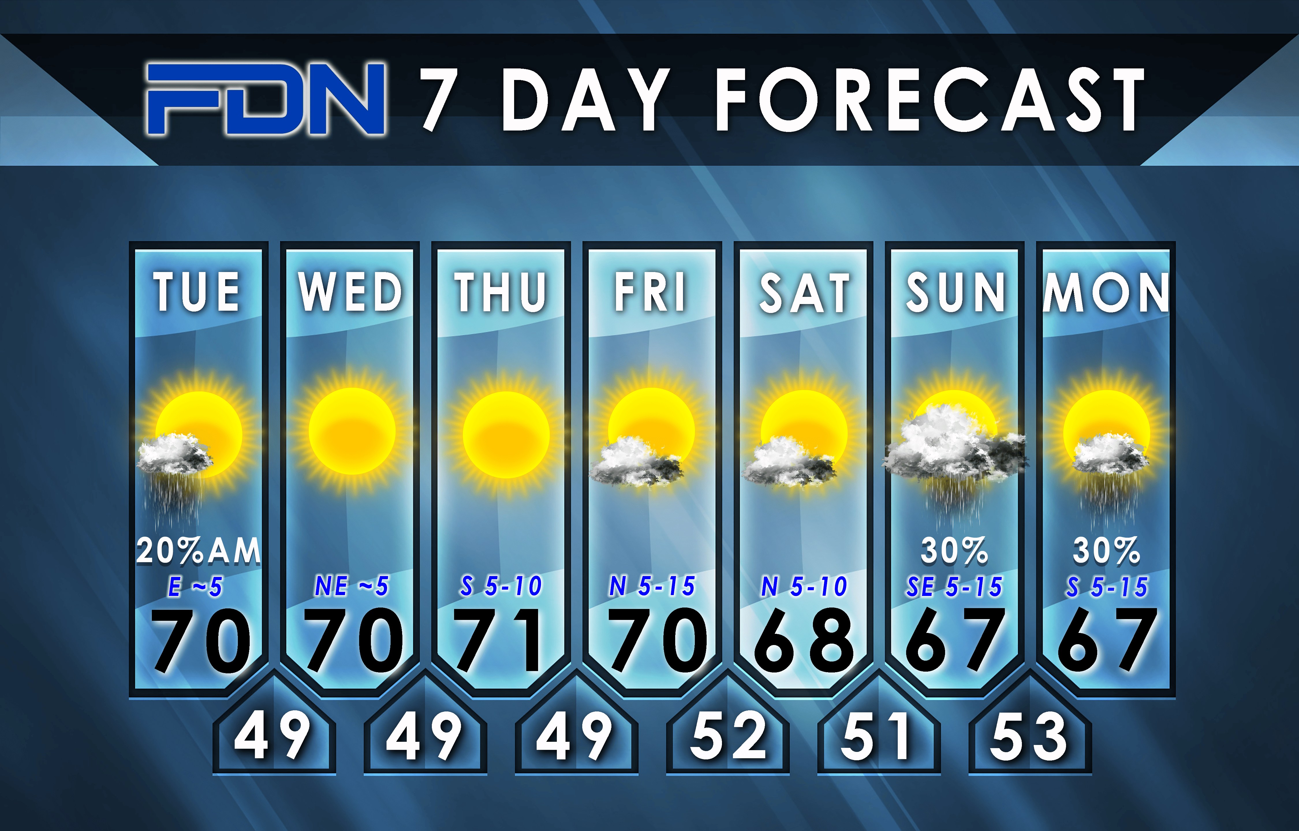
Here are the details of the forecast.


/cloudfront-us-east-1.images.arcpublishing.com/gray/6QYDZDU6PBAMPBSJYU7HEZJWHU.jpg)


/cloudfront-us-east-1.images.arcpublishing.com/gray/SJ2XTF2NMJETZJZJDP6LHUK2OA.png)


