Houston weather forecast: Incoming rain, cooler temperatures this week

It's been a time of topsy-turvy weather over the last week for Houston !
Last week on Halloween, our high temperature was close to 60 with lows in the 40s! That was jackets and boots kind of weather!
One week later, temperatures climbed to the middle 80s which is over 20 degrees warmer than the last week's chilly temps! College Station also set a new record high temperature for the day at 89 degrees.
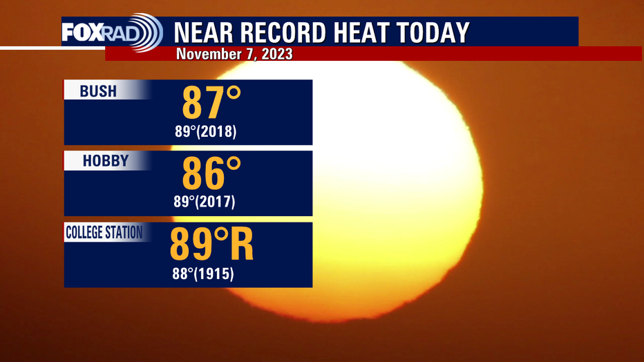
That breaks the old record of 88 that was on the record books for over 100 years!
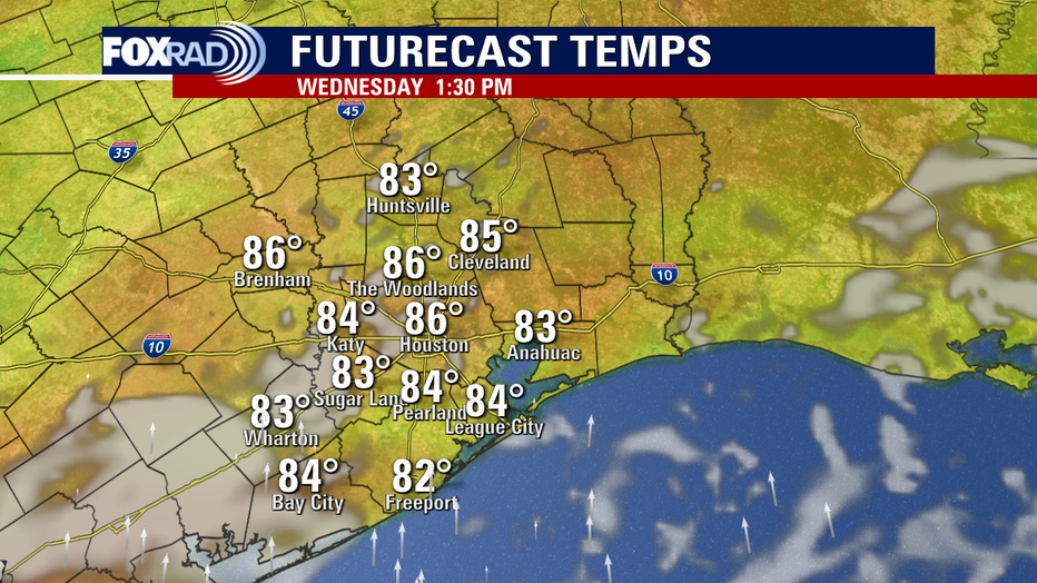
So summer heat is back in November! It will be another warm and humid afternoon Wednesday with plenty of humidity.
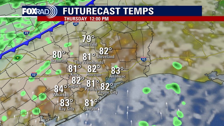
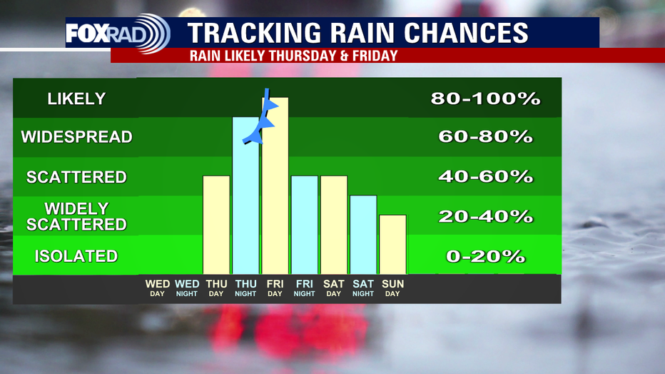
But look for another big pattern change on Thursday and Friday as a strong cold front arrives! We still make it into the low 80s Thursday for the early afternoon with a few showers possible.
The front will bring a big drop in temperatures again and the possibility for some heavy rain. Showers will increase Thursday night with a few heavy downpours and rumbles of thunder possible.
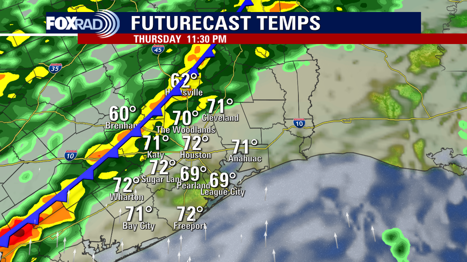
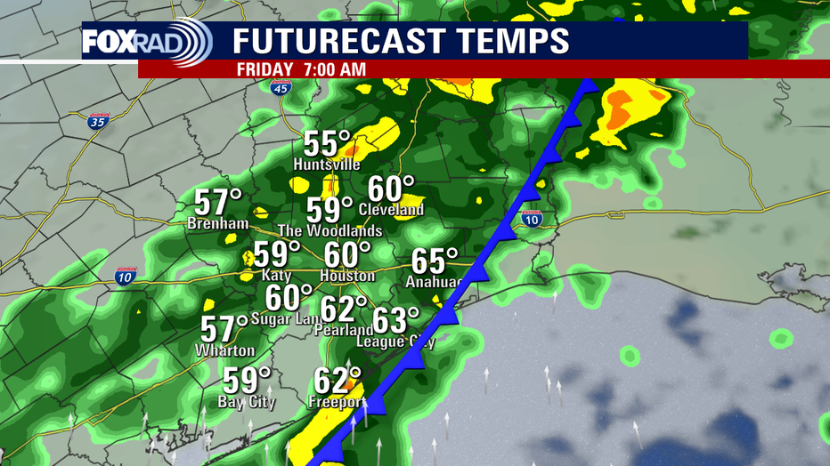
But rain is expected to become even more widespread overnight Thursday into early Friday. Friday morning could end up being pretty soggy for the morning rush with steady and at times heavy rain.
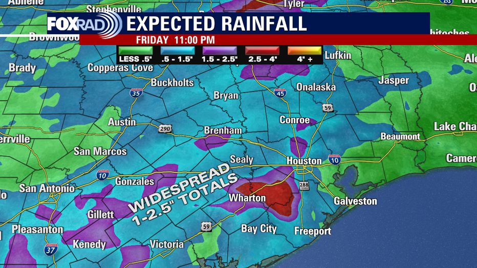
Rain will linger for much of Friday but should get a bit lighter. Between Thursday and Friday, many areas will likely pick up anywhere from 1 to 2.5" of rain.
Models are indicating the front may stall just offshore to our Southeast this weekend. That would allow more rounds of rain to possibly impact Southeast Texas. At this point, it appears that the heaviest of the rain over the weekend will stay out over the Gulf of Mexico.
The other part of this front is the chill returning.
Look for a noticeable drop in temperatures from Friday and through the weekend.


