Houston weather: Rain, cooler temperatures expected over the next few days

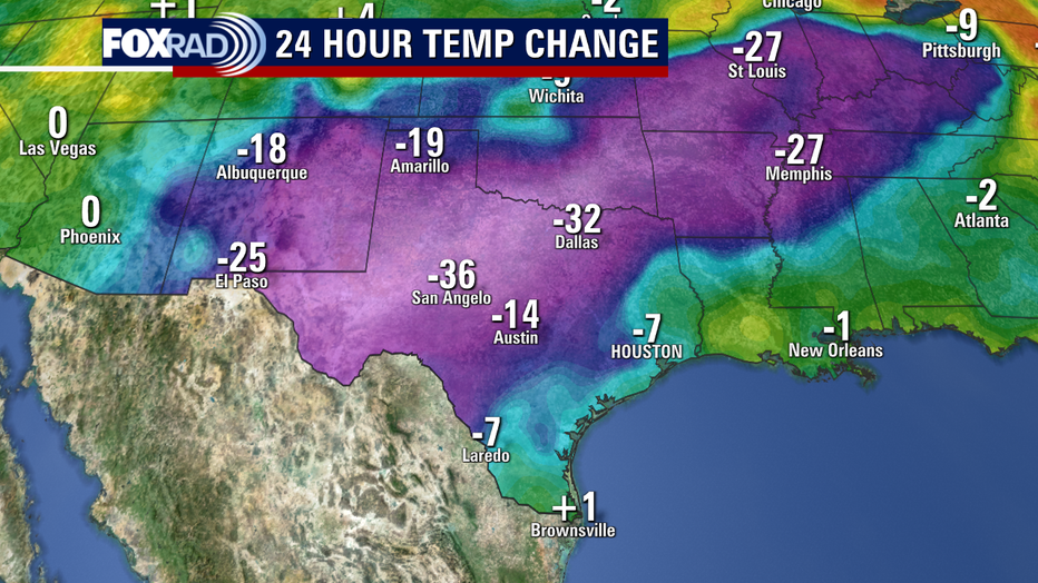
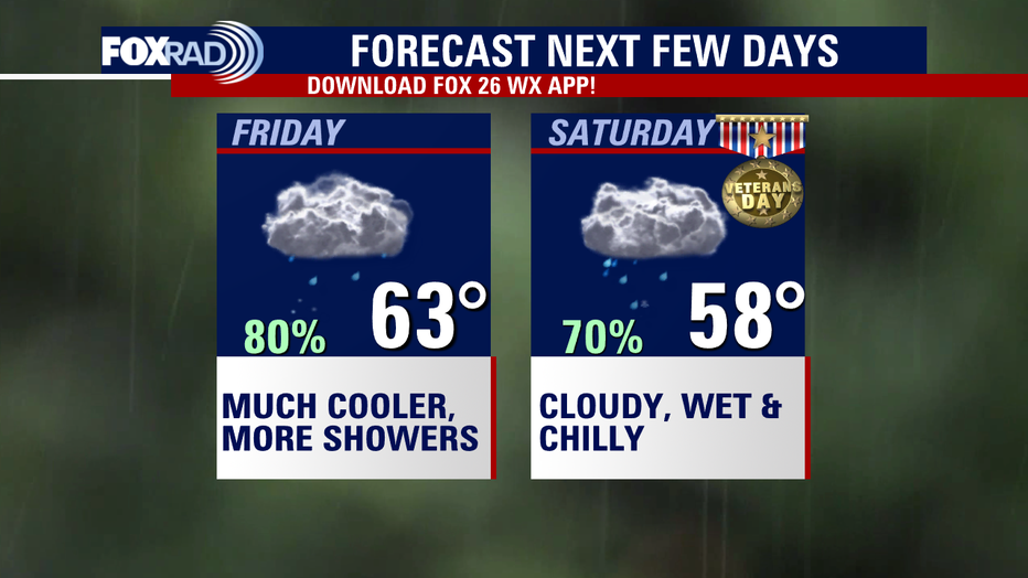
Big changes are heading our way over the next 24 hours! Look for around a 20-degree temperature drop for the Houston area from Thursday afternoon to Friday afternoon with a strong cold front rolling in Thursday evening.
MORE HOUSTON WEATHER
Rain will continue to build in tonight with a few rumbles of thunder possible. There is a low marginal 5% risk for "Excessive Rain" that could lead to a few flooding issues through tonight for Houston and areas west of Houston.

That means you should slow things down, watch out for pooling of water on the roads, and find an alternate route if you encounter any flooded streets. Rainfall totals from this evening through Saturday night will likely range from 1-3" for most areas with some isolated 4"+ totals possible, especially near the coast.
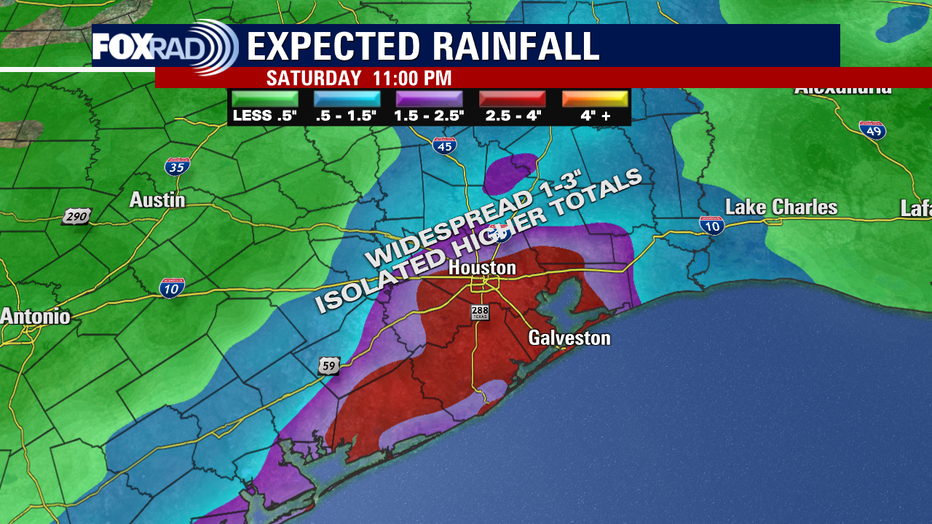
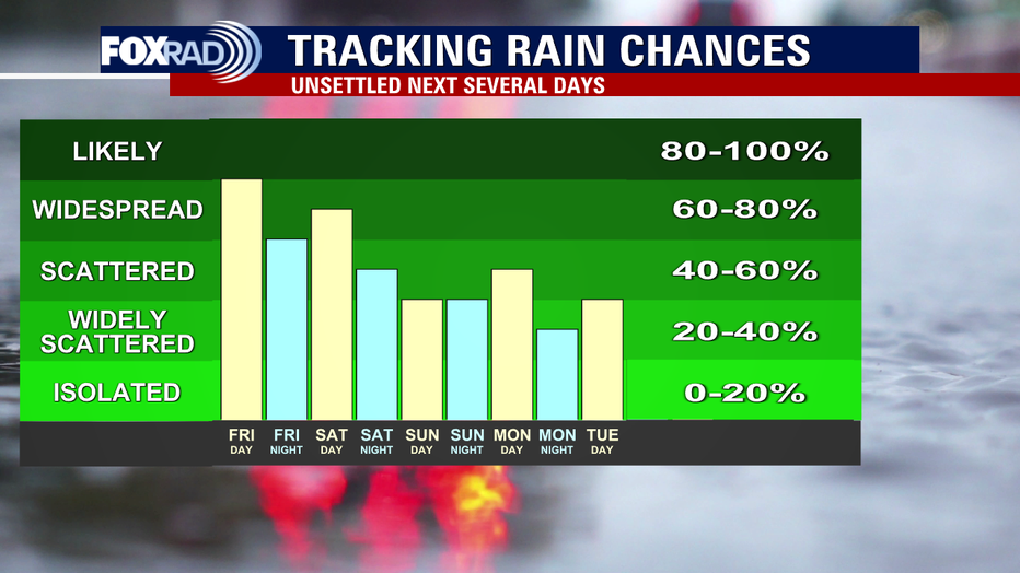
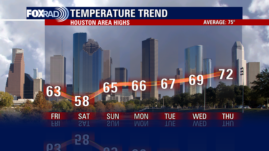
Temperatures will fall from the 80s today to the upper 50s tonight. Temperatures will only rebound to the low 60s for most areas Friday with widespread light rain. Weekend plans may also need to be adjusted with more rounds of rain expected. A front will likely stall just offshore and that will mean a soggy Veterans Day with the heaviest rain near the coast.
In fact, we stay on the wet side with rain chances lingering for the next several days.
It would help if you also rounded up the jackets, coats, sweaters and boots with temperatures expected to remain below average for at least the next week.
So have fun this weekend but be careful on the roads and make sure to keep the rain gear with you!


