TIMELINE: Cloudy skies, rainy weather, breezy conditions expected in Central Florida Wednesday

Today's high: 77 degrees | Tonight's low: 69 degrees
TODAY:
We have another day of cloudy skies, passing showers and gusty breezes. Rain coverage today doesn't look to be quite as high as yesterday – 40% near Orlando and 60% over the far northwestern counties.
Gusty ocean breezes will gusts to 30+ mph. The cloudy skies, breeze and rain will serve to keep a lid on temps today.
Most locations will see highs in the mid-upper 70s this afternoon with mild overnight lows and near 70 degrees. A High Surf Advisory is in effect until further notice. A flood watch is in effect through Thursday afternoon for the coastal counties as the heaviest rain (excess of 4") could fall in these areas.
:
It is not a good day to head to any of our east coast beaches. Passing showers and very gusty winds continue. Surf will build quickly today through tonight. Coastal flooding could also occur during the times of higher tides. Rip current risk remains high.
THEME PARKS:
It will be cloudy with passing showers at the theme parks today. Highs remains in the mid-upper 70s. Rain chances are around 40% with the best chance through the afternoon.
:
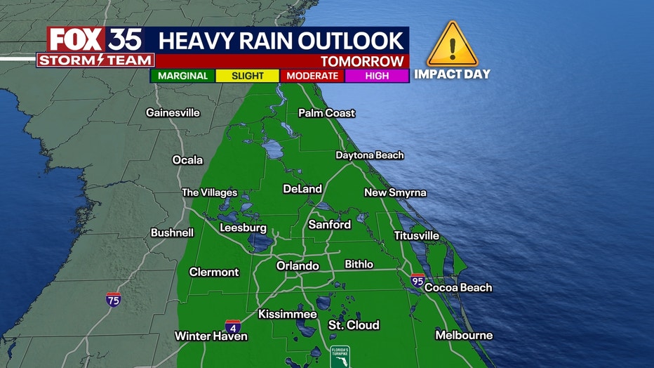
A FOX 35 Weather Impact Day has been issued for Thursday as the heaviest rain moves across the region. Low pressure will move in from the Gulf of Mexico with a secondary low spinning up somewhere near South Florida.
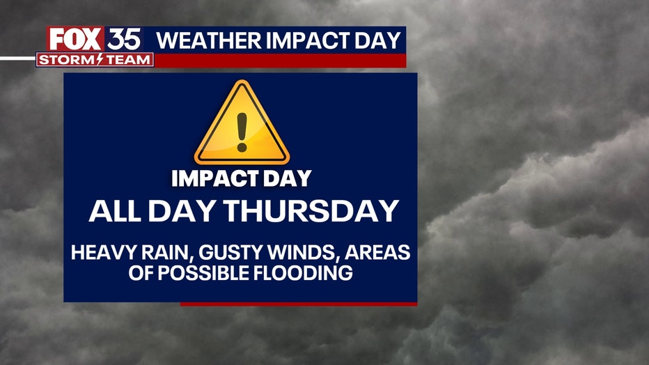
Rain chances will sharply rise in response to these features. Locally heavy rain, gusty winds-especially along the beaches and the possibility of low lying flooding will all be present over the next couple of days with a focus on Thursday.
Image 1 of 3
We could see anywhere from 1-3" possible in total through the Orlando metro, and amounts at 3"+ in southern Brevard and Osceola Counties.
TROPICS:
The FOX 35 Storm Team is monitoring the latest tropical models as they continue to suggest a low pressure system will develop in the Caribbean this week and could become a tropical depression during that time. Overall trends have this system developing and moving northeastward over Jamaica, Cuba and Hispaniola before heading out into the Atlantic by this weekend.
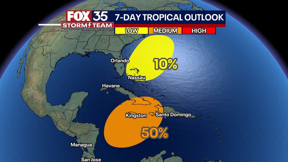
We are also monitoring an area of low pressure that is expected to develop near south Florida late week. This system is then forecast to move northeastward off the east coast of the U.S. late through the weekend.


