Sunshine and mild temperatures to wrap up the work week!

Wednesday brought continued warm and dry conditions, with temperatures soaring close to record levels. Boise peaked at 67°, just two degrees shy of the record high, while Twin Falls reached 65°! These temperatures are a significant 15-20° above the "normal" for mid-November. Meanwhile, the lower Treasure Valley experienced slightly cooler temperatures due to a temperature inversion.
Idaho News 6As we move through the rest of the week, a high pressure ridge situated southeast of Idaho will expand into the Pacific Northwest. This will result in persistent stagnant air, temperature inversions, and hazy conditions. The Treasure Valley, extending to Mountain Home, is currently under an Air Stagnation Advisory, which will remain in effect until 11:00 AM on Thursday.
Throughout the past few days, a low pressure system has been spinning over the Pacific Ocean, with some cloud cover and light rain showers reaching northern Nevada and southern Idaho. However, as we progress through the morning, those clouds will gradually clear, making way for a sunny to mostly sunny afternoon across Idaho.
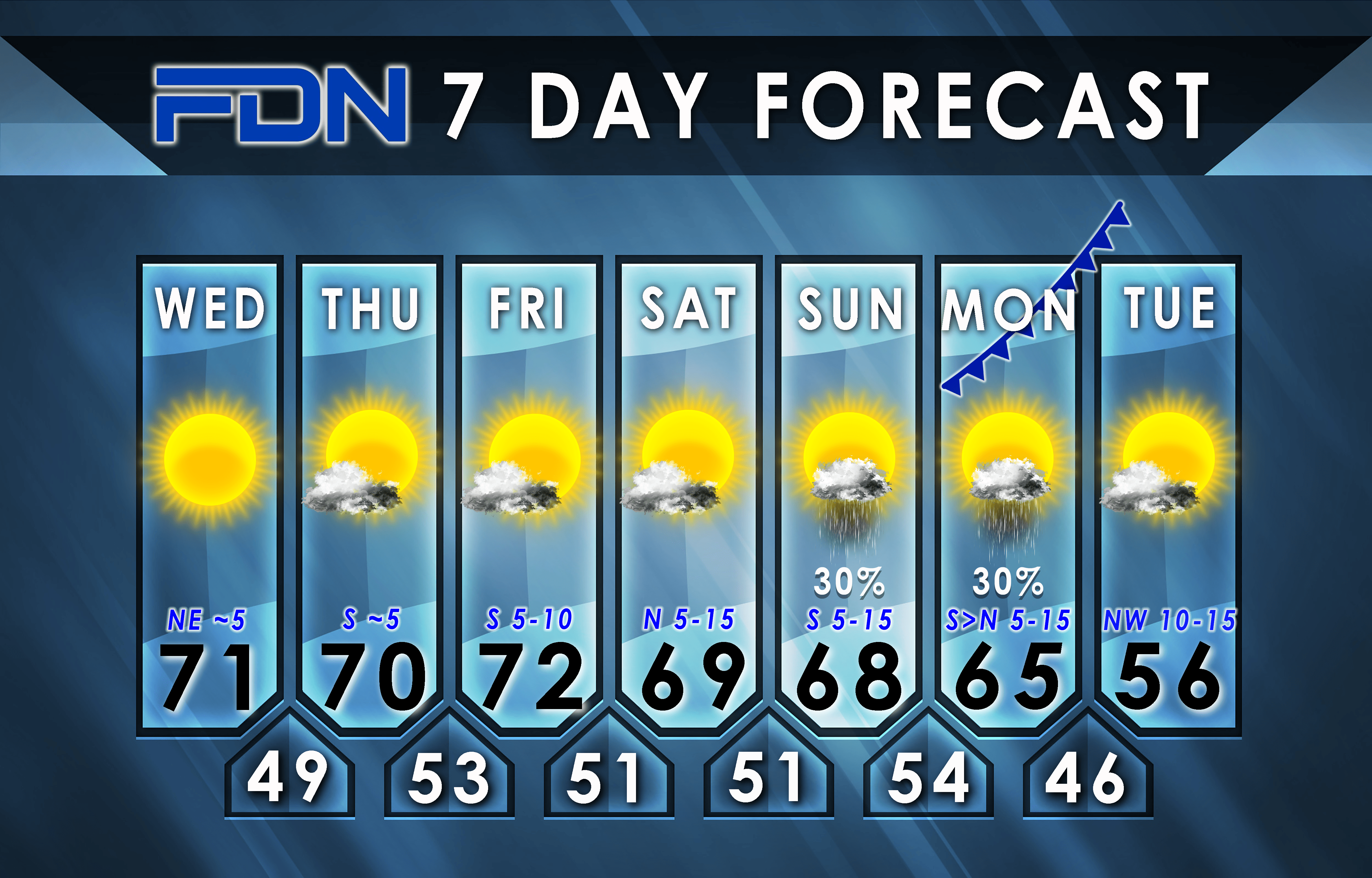
We can expect to enjoy sunny and mild temperatures for the remainder of the work week, with daytime highs around 60° in the Treasure Valley. However, on Saturday, the high pressure ridge will begin to break down, allowing the Pacific low to move inland. This shift will bring cloud cover and rain showers to the region by Saturday evening.
By Sunday morning, snow levels will lower to 5000 feet. While rain showers will come to an end in the valley early on Sunday, snow showers will linger in the central mountains. Moving into early next week, high pressure will rebuild, leading to a return of seasonably mild temperatures and mostly clear skies leading up to Thanksgiving. However, we are keeping an eye on a storm system that may impact the region on Thanksgiving Day.
Idaho News 6


/cloudfront-us-east-1.images.arcpublishing.com/gray/GZFLDKRA45CHDCB6AJWVOE4COA.png)


