Actionnewsjax
Talking the Tropics With Mike: Recap of the ‘23 Atlantic hurricane season: more bark than bite – Action News Jax
C.Nguyen3 months ago
:quality(70)/cloudfront-us-east-1.images.arcpublishing.com/cmg/JIFG55NSN5HKZK6LKEZ4C7UU5I.jpg)
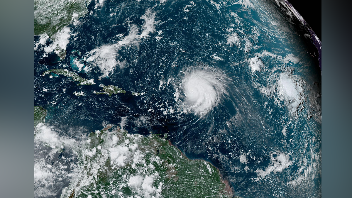
Jacksonville, Fl. — The “Buresh Bottom Line”: Always be prepared!.....First Alert Hurricane Preparation Guide... City of Jacksonville Preparedness Guide... Georgia Hurricane Guide.STAY INFORMED: Get the * FREE * First Alert Weather appAction News Jax app for AppleFor AndroidWATCH “Preparing for the Storm”WATCH “The Ins & Outs of Hurricane Season”READ the First Alert Hurricane Center “Survival Guide”LISTEN & WATCH “Surviving the Storm” - WOKV Radio & Action News Jax***** ALWAYS CHECK & & UPDATES! *****aping windows is *not* recommended & will not keep glass from breaking. Instead close curtains & blinds.Realize the forecast cone (”cone of uncertainty”) is the average forecast error over a given time - out to 5 days - & *does not* indicate the width of the storm &/or where damage that might occur. The Atlantic 2023 hurricane season was “active” if one measures in terms of numbers but intensity & landfalls were *for the most part* not as significant as one would expect for such an active season. A video recap:
:quality(70)/d1hfln2sfez66z.cloudfront.net/11-30-2023/t_35eb12534c99495f8a0c5dca2ca7dec9_name_file_1920x1080_1200_v3_1_.jpg) A Review of the 2023 Hurricane Season The ACE - accumulated cyclone energy which measures the strength & duration of tropical storms & hurricanes - did measure above avg. at 148 vs. the seasonal avg. of 124 or about 20% greater than the approximately 30-year average.
A Review of the 2023 Hurricane Season The ACE - accumulated cyclone energy which measures the strength & duration of tropical storms & hurricanes - did measure above avg. at 148 vs. the seasonal avg. of 124 or about 20% greater than the approximately 30-year average. The high number of tropical storms was atypical - but not unexpected - considering a strengthening El Nino (warming of the equatorial Pacific). However, unseasonably warm sea surface temps. compensated some for the increased mid & upper level wind shear. Still... the majority of strong tropical cyclones stayed well out to sea with no landfalling systems in the Caribbean & only one landfalling hurricane for the U.S.

 Seasonal forecasts by Colorado State University (Dr. Phil Klotzbach) & NOAA were generally in the “neighborhood” when it comes to pure numbers but were a little high on the number of hurricanes & “major” (Cat. 3+) hurricanes:

 So the 2023 hurricane season will be remembered for Cat. 3 Idalia (Cat. 4 for a time over the Eastern Gulf of Mexico) making landfall in the Big Bend of Florida on Aug. 30th. The storm turned east/northeast once inland producing a swath of strong winds & heavy rain well inland over N. Central Fl. & much of Ga. A few tornadoes occurred in Glynn Co., Ga. about 40-50 miles north of Jacksonville. Power was out for as long as several days from Lake City, Fl. to Waycross, Ga. Impacts to Jacksonville & Duval Co. were minimal. For more on Idalia specifically, go to the “Buresh Blog” * here *.
:quality(70)/d1hfln2sfez66z.cloudfront.net/08-30-2023/t_e7d74b6d5cc5421689f6734c64b14ca0_name_file_960x540_1200_v3_1_.jpg) Impacts of Hurricane Idalia in Cedar Key There were other notable tropical cyclones on the Pacific side. Hilary - though well off its peak - hit Southern California Aug. 20th with record rainfall including some desert areas resulting in up to 600% of their average August rainfall!
Impacts of Hurricane Idalia in Cedar Key There were other notable tropical cyclones on the Pacific side. Hilary - though well off its peak - hit Southern California Aug. 20th with record rainfall including some desert areas resulting in up to 600% of their average August rainfall!
 Then the “poster child” of the season was Cat. 5 Otis hammering Acapulco on Oct. 25th after rapidly intensifying just offshore. Otis was the most powerful hurricane to ever directly hit Acapulco & will result in years of rebuilding.
 A month by month breakdown of the Atlantic hurricane season: No Atlantic named storms.*** LOCAL (Jacksonville/NE Fl./SE Ga.) oneThe Atlantic Basin Overview: No areas of concern...
 The upper oceanic heat content (UOHC) [tropical cyclone heat potential/TCHP] across the SW Atlantic, Gulf & Caribbean:


 Water vapor loop (dark blue/yellow is dry mid & upper level air):
 November tropical cyclone origins:
 Averages below based on climatology for the Atlantic Basin for November (7 hurricanes so far, 19 tropical storms):
 Wind shear:


 Saharan dust spreads west each year from Africa by the prevailing winds (from east to west over the Atlantic). Dry air - yellow/orange/red/pink. Widespread dust is indicative of dry air that can impede the development of tropical cyclones. However, sometimes “wanna’ be” waves will just wait until they get to the other side of - or away from - the plume then try to develop if other conditions are favorable. In my personal opinion, way too much is made about the presence of Saharan dust & how it relates to tropical cyclones. In any case, the peak of Saharan dust typically is in June & July.
 “Vince” is the next name on the Atlantic list (names are picked at random by the World Meteorological Organization... repeat every 6 years). Historic storms are retired [Florence & Michael in ’18... Dorian in ’19 & Laura, Eta & Iota in ‘20, Ida in ‘21 & Fiona & Ian in ‘22]). In fact, this year’s list of names is rather infamous with “Katrina”, “Rita” & “Wilma” retired from the ‘05 list & “Harvey”, “Irma”,“Maria” & “Nate” from the ‘17 list. The WMO decided - beginning in 2021 - that the Greek alphabet will be no longer used & instead there will be a supplemental list of names if the first list is exhausted (has only happened three times - 2005, 2020 & 2021). The naming of tropical cyclones began on a consistent basis in 1953. More on the history of naming tropical cyclones * here *.
 East Atlantic:


 Mid & upper level wind shear (enemy of tropical cyclones) analysis (CIMMS). The red lines indicate strong shear:
 Water vapor imagery (dark blue indicates dry air):
 Deep oceanic heat content over the Gulf, Caribbean & deep tropical Atlantic. The brighter colors are expanding dramatically as we near the peak of the hurricane season.:
 Sea surface temp. anomalies:
 SE U.S. surface map:
 Surface analysis centered on the tropical Atlantic:
 Surface analysis of the Gulf:
 Caribbean:
 Atlantic Basin wave period forecast for 24, 48, 72 & 96 hours respectively:


East/Central Pacific:


 West Pacific:
 Global tropical activity:


Cox Media Group
East/Central Pacific:
Cox Media Group
Read the full article:https://www.actionnewsjax.com/weather/talking-tropics-with-mike-recap-23-atlantic-hurricane-season-more-bark-than-bite/JGMLLFP7ZJHRVG2UXGVVK52HB4/
0 Comments
0


:quality(70)/cloudfront-us-east-1.images.arcpublishing.com/cmg/OERZOAZCET2A242QOQ5E2ON7LY.jpg)


