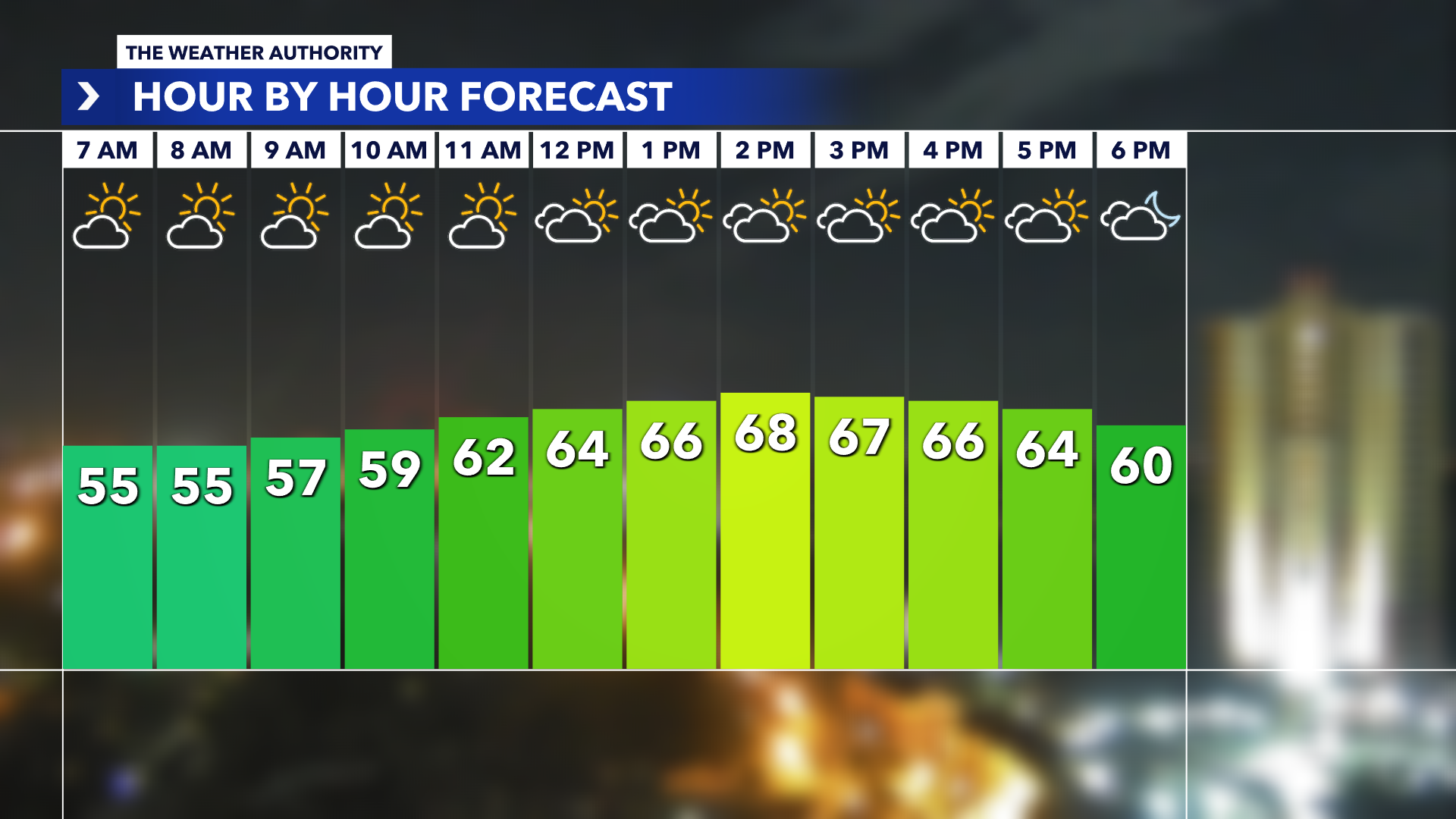
Cold front will bring temperatures into the 50s in South Florida
South Floridians can expect temperatures to dip into the 50s this week as a cold front sweeps through the state.
The cooler temperatures will begin Tuesday morning and extend until Thursday morning, said National Weather Service meteorologist Sammy Hadi.
Low temperatures Tuesday morning will hover around the lower 60s and even upper 50s in inland suburbs and reach up to the low- to mid-70s, Hadi said. A cloud cover and cool breeze will both work to keep temperatures on the lower end, he said, with Tuesday having the coolest daytime temperatures.
Wednesday will be slightly colder in the early morning, but the trend will be the same, with temperatures in the low 60s along the immediate coast and upper 50s in more inland areas.
Temperatures will stay “decently chilly” into Thursday, Hadi said, but the highs during the day will trend back to the temperatures most South Floridians are used to in the upper 70s and lower 80s. By Friday and into the weekend, the warmth will fully return.
“This is only the second cold front that was really significant enough to get us this cool per se,” he said.
The first, since March, that is, happened in October when temperatures dipped into the 50s at night.
Since October, there has not been a cold front strong enough to actually lower temperatures a considerable amount. Last week, right before Thanksgiving, a cold front pushed through , but it kept temperatures in the 70s.
With winter less than one month away, the National Weather Service predicts there’s a “reasonable chance” for this winter to be cooler than the past several winters due to temperatures tending to be cooler during El Niño years, according to NWS’ most recent newsletter.
“Usually November is a transitionary period between that warm muggy months of summer time and early fall to a colder, cooler period,” Hadi said.


:quality(70)/cloudfront-us-east-1.images.arcpublishing.com/cmg/3QXMVQ6CGZCD3BMDKYM4QEFK7I.png)


