Washingtonpost
Lake-effect snows could dump up to 30 inches in Upstate New York
A.Wilson3 months ago
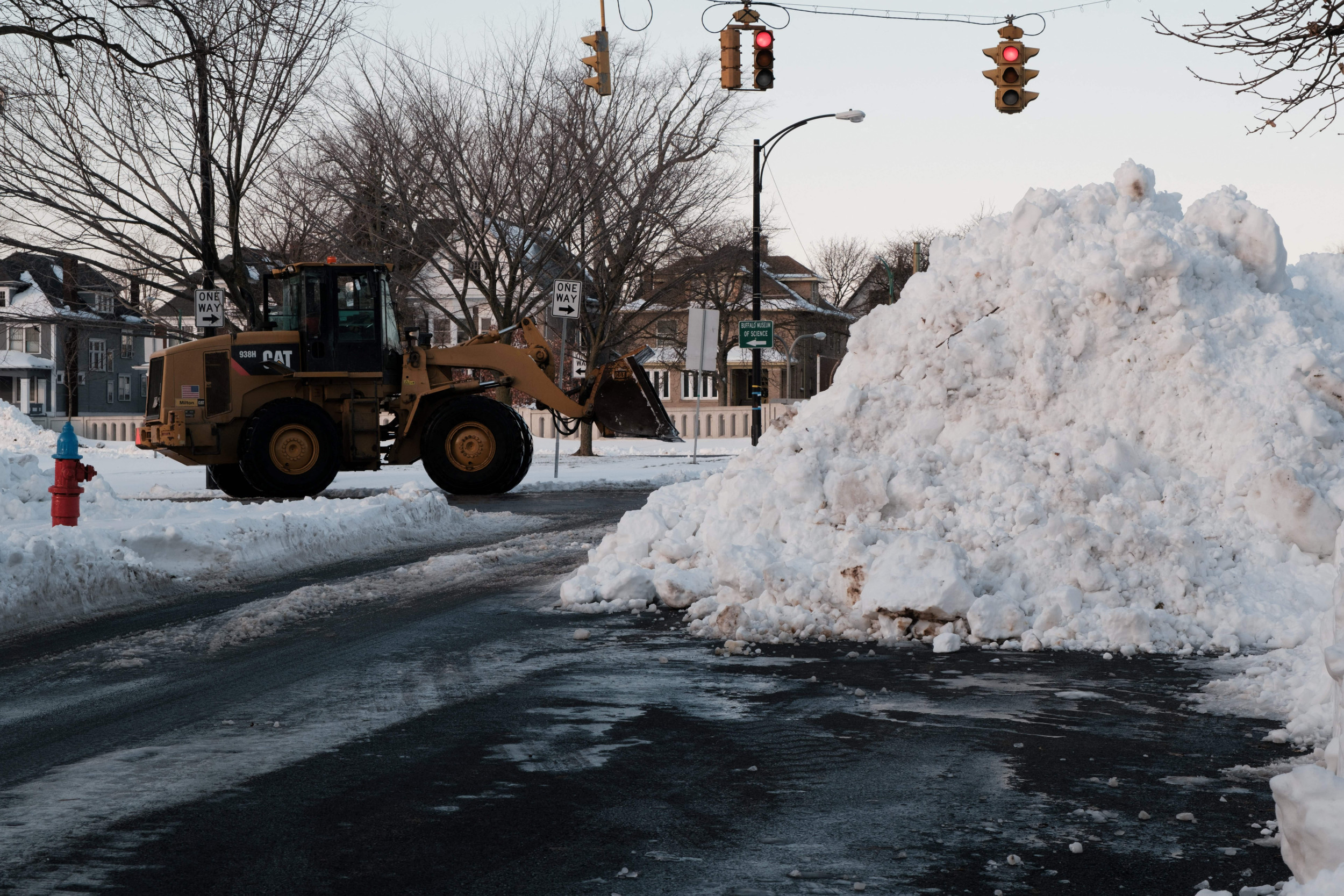
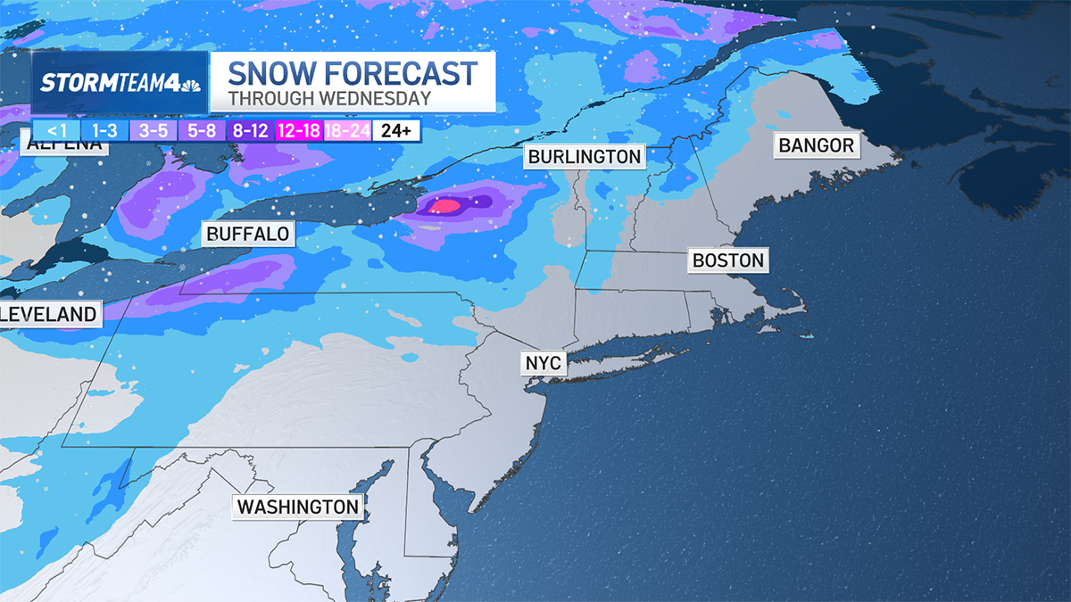
Heavy lake-effect snows are plastering parts of Upstate New York, accompanied by strong winds, plummeting temperatures and the chance of thunder and lightning. Totals of 20 to 30 inches are expected downwind of Lakes Erie and Ontario, the heaviest expected Monday night into Tuesday. Want to know how your actions can help make a difference for our planet? , in your inbox every Tuesday and Thursday. Lake-effect snow warnings remain in effect through early Wednesday for extreme northeastern Pennsylvania from Erie to near Buffalo, as well as around the Tug Hill Plateau from Fulton to north of Watertown, N.Y. Syracuse, N.Y., is also included in the zone. Rapid changes in visibility are anticipated, posing issues for drivers on Interstates 80, 90 and 91. Whiteout conditions are possible in the worst of the snow bands, which may contain snowfall rates exceeding 3 inches per hour.
What to know about lake-effect snow
Upstate New York is no stranger to lake-effect snow, which forms when cold winds blow over comparatively warmer ice-free waters early in the winter season. Just last year, back-to-back lake-effect snowstorms crippled the greater Buffalo area, contributing to a seasonal total of 133.6 inches. The city’s annual average is around 95 inches. In mid-November 2022, up to 61⁄2 feet came down in just 60 hours, the heaviest concentrated in the southern Buffalo suburbs of Hamburg, Blasdell and Orchard Park — where the Buffalo Bills play. Yet it all melted by the end of the month. Then a historic blizzard with hurricane-force winds claimed nearly four dozen lives around Buffalo in the days leading up to Christmas. Wind chills dropped to minus-20. Thousands of cars were left abandoned on area roadways. The airport tallied 51.9 inches of snow. This lake-effect episode won’t be nearly as severe, since winds won’t be blowing directly down the lengths of Lakes Erie and Ontario. (A wind fetch parallel to the lake means pockets of air are in longer contact with the warmer waters, extracting greater moisture and contributing to heftier snowfall.) Instead, the winds will be more westerly. That won’t align with the 241- and 193-mile-long axes of Lakes Erie and Ontario, respectively. The result will be to cut back markedly on snowfall in general and to shunt the snow bands farther south of Buffalo and Rochester.Expected snow totals
Off Lake Erie, a general 8 to 16 inches of snow will fall. The heaviest snowfall will be in northern and western Chautauqua, northern Cattaraguas, southern and western Erie and most of Wyoming counties. Localized totals up to 20 inches are possible over the Chautauqua Ridge. Downstream of Lake Ontario, most folks on the Tug Hill Plateau will pick up 1 to 2 feet. A few areas near the Oswego-Jefferson county line may nick 30 inches. The lake-effect snow bands had already materialized by Monday morning. The Lake Erie band was centered between Jamestown and Dunkirk, but the Lake Ontario one wasn’t quite as solid — it was made up of individual convective cells, or sporadic heavy show showers, rather than taking the shape of one thick band. By Monday night, an approaching upper-air disturbance will introduce greater moisture, increasing the intensity of the snow band. An influx of even chillier air in the upper atmosphere will also help destabilize the lower atmosphere, or foster greater upward motion within air pockets at the surface. That will boost snowfall rates and could also spark isolated lightning strikes. The National Weather Service Storm Prediction Center has drawn zones downwind of the lakes where a few rogue lightning discharges are possible. Around or after midnight, a subtle shift of the winds to more west-southwest rather than just due west could cause the snow bands to wobble northward. The southern band probably still won’t get to Buffalo, but it could briefly flirt with Hamburg, Orchard Park or East Aurora. Winds, meanwhile, will gust near 40 mph. By midday Tuesday, winds will go more northwesterly, shunting the snow bands to the south as they largely disintegrate.What’s causing the lake-effect snow?
A pocket of high-altitude cold air, low pressure and spin to the northwest known as a shortwaveis causing the lake-effect snowThe broad flow circulates around that upper-level low. The low has already swung a cold front through the region, which has made it to the Interstate 95 corridor in the Mid-Atlantic. Winds behind the front have turned west-northwesterly as temperatures drop. That cold air is what’s blowing down the lakes and picking up moisture. Lake-effect snows will be more severe if a greater difference exists between lake water temperatures and the temperature of the air above. That’s why the snows are more prevalent in November and December, before the waters have chilled down for the winter and ice has begun covering the Lakes. At present, waters in Lake Erie are around 49 degrees, but air temperatures on Monday night at the surface will drop into the mid-20s. Above the ground, the air will be far more frigid.Read the full article:https://www.washingtonpost.com/weather/2023/11/27/lake-effect-snow-buffalo-new-york-erie-ontario/
0 Comments
0


